Malibu · APN 4457-023-007
Entitled · Coastal Development Permit issued · Term extended
2826 Coralglen DriveMalibu, California 90265
Five and a quarter gross acres on a private knoll above Corral Canyon — just under four net of the recorded easements — with the hard part already finished: a Los Angeles County Coastal Development Permit approving an 8,437 square-foot program, an approved wastewater system, access of record, and title held free and clear.
- 5.23 acres227,645 SF gross · ±3.93 net
- 8,437 SFapproved program · 5,022 SF residence
- Nov 2027permit term · extension approved
- 9,996 SFbuilding site area
- Free & clearno loans of record
- 1.9 milesto Pacific Coast Highway
What is approved
An 8,437-square-foot program, and the approvals run with the land.
In the Santa Monica Mountains the entitlement is the scarce commodity and the process routinely runs years. That is the whole proposition here. The detail below is drawn from the County’s hearing package; the executed Findings and Order is still being obtained and is listed under open items.
- The residence
5,022 square feet across two terraced levels stepping down the hillside: five bedrooms, four bathrooms, wine room, office and pool deck. An 800-square-foot attached four-car garage and 2,615 square feet of covered outdoor living bring the approved program to 8,437 square feet. Thirty feet maximum height, Type V-B construction, interior sprinklers to NFPA 13D plus an exterior automatic system, and a hammerhead turnaround.
- The palette
Set by the entitlement rather than left to taste: earth-toned wood, stucco and concrete, non-glossy roofing, low-reflectivity glass and shielded dark-sky lighting, with roughly 2,410 cubic yards of grading.
- The approvals
A Minor Coastal Development Permit from Los Angeles County Regional Planning, carrying clearances from the Fire Department, Parks and Recreation, Public Health, Public Works and the Environmental Review Board, together with a variance for a widened private driveway.
- The term
The grant became effective November 5, 2024, on a two-year term. A one-year extension has been approved, carrying it to November 2027. The County allows one extension and no more. Condition 31 separately bars grading between October 15 and April 15, so the last practical window to commence closes in mid-October 2027 rather than at the November date. The County’s written confirmation of the extension is listed under open items below.
- 151 notices, no opposition
The County mailed 129 notices of public hearing to every owner within a thousand feet and 22 more on the Malibu Zoned District courtesy list, alongside newspaper publication and posting of the property. The staff report records no public comment and no adverse agency comment. Neighbor opposition is what ordinarily ends a Santa Monica Mountains entitlement. This one drew none.
- Not a ridgeline
The property is not within a Significant Ridgeline and not within a Scenic Resource Area, which is why the full thirty-foot height was granted rather than a reduced envelope. Setbacks are met, and the parcel is lawfully created — which removes the Certificate of Compliance pathway and its development-credit trigger. None of the thirty-one conditions imposes a Transfer of Development Credit obligation; habitat mitigation runs instead through an impact fee payable at permit issuance.
The file
Every approval, organized the way a buyer reads it.
These are the documents already in hand. They are grouped by subject and each one says, in plain language, why it matters to you. Nothing here is a summary of a document we have not read — if it is listed, it is on file.
LA County ApprovalsIssued, not pending. What separates this from a raw lot.6
Environmental and SiteHabitat, CEQA and the findings that set the envelope.3
WastewaterThe approved system and the County's finding on it.1
Title and EntityFee simple, free and clear, access of record, seller authority confirmed.7
AccessHow you reach it, and on whose easement.2
Property RecordsAssessor, parcel map, lot size and flood.4
23 documents on file · updated September 11, 2026
Download the whole fileAll 10 files in one folder, roughly 46 MB. No sign-in required.Open the data room →Straight answers
What is not settled yet.
A property this far along still has open items. Here they are, before you ask. Each one is being worked and the paper will be posted here as it lands.
- The signed order
Everything above concerning the permit comes from the hearing package, in which the findings and conditions pages are marked draft. The executed Findings of the Hearing Officer and Order has been requested from LA County Planning. Until it is in hand, treat the conditions as proposed rather than final.
- Permit term
The grant became effective November 5, 2024, and a one-year extension has been approved, carrying it to November 2027 on the entitlement consultant’s advice. The County’s own written confirmation, stating the date the grant now runs to, has been requested and will be published here; a buyer should treat the exact day as unconfirmed until it is. Two things are already settled. The County allows one extension only, so no further relief exists after 2027. And Condition 31 bars grading between October 15 and April 15, which closes the last practical window to commence in mid-October 2027.
- The remediation plan
The building-code cases behind the 2013 notice close when the unpermitted grading is permanently remediated under this permit. The entitlement consultant has confirmed the permanent remediation plan is not yet finalized. Until it is, neither those cases nor the recorded notice can be cleared, and the cost of that work has not been scoped by any party.
- The 2013 code violation
A Notice of Building Code Violation recorded in November 2013 (Instrument 20131615182) is still on title. The zoning case behind it, No. 13-0012624, closed on April 6, 2017. The related building-code cases have been on hold since October 2017 pending permanent remediation under this permit, which means they close when the house is built. The recorded notice remains of record until then.
- A Coastal Commission enforcement matter
Violation No. V-4-13-0210 was opened by the Commission in 2013 and relates to the same unpermitted grading as the County’s building-code cases. Whether it has since been closed is not yet confirmed, and the question has been put to the Commission. On the exposure, one finding is worth knowing: the County’s approval establishes that this parcel does not lie between the nearest public road and the sea, which puts the Commission’s administrative penalty mechanism under Public Resources Code section 30821 — the one behind the widely reported Malibu access fines — out of reach here. The realistic risk is delay, not a penalty.
- Two Coastal Commission deed restrictions
Both are now in the document file above, and they are not a matched pair. The 2005 instrument implements Coastal Development Permit 4-04-106 and has been read in full: it fixes no building envelope, dedicates no open space and states no area limits, and the permit it implements expired without use. The 2012 instrument implements a different permit, 4-09-036, approved in 2010 for a similar project that also expired. Its recorded form does not attach the Special Conditions it incorporates by reference, so what it restricts cannot be read off the record; those conditions are being obtained from the Commission. Both carry standard assumption-of-risk, earth-tone and dark-sky lighting provisions consistent with the 2024 County conditions. Neither has been released of record, and both remain title exceptions until something records.
- The drawings
The approvals run with the land. The Aux Architecture drawings do not — the architect retains copyright, and the seller has confirmed that a fee applies if a buyer brings its own architect. A written authorization setting out the license terms and that fee is being obtained from Aux and will be posted here.
- Construction documents
The approved set is an entitlement set, marked not for construction and drawn to the 2017 code cycle — three cycles behind current. Plan check to current code is the buyer’s scope, and four to seven months for the drawings, before the County’s own review begins, is a realistic allowance.
- Water
The purveyor is Las Virgenes Municipal Water District, confirmed three ways: the Department of Public Health clearance letter of May 3, 2023, the owner’s written confirmation, and a Las Virgenes special assessment carried on the parcel’s own tax bill. Earlier references in the file to Los Angeles County Waterworks District No. 29 are superseded. A conditional statement of service dated September 2022 is on file. What is not yet in hand is a current will-serve letter for this parcel, and the terms of a Limited Water Service Agreement recorded in 1977 (Instrument 77-222607). Both are being requested and will be published here.
- Wastewater, after the Coastal permit
The onsite wastewater treatment system holds pre-Coastal approval from September 2022. Post-Coastal review is still required before a building permit issues, and four to ten weeks is a fair allowance for it.
- Property taxes
The defaulted 2023-24 year was redeemed in full on August 26, 2026 and the County receipt is held. Two 2025-26 installments are shown as delinquent on the August title report and are being reconciled with the County; the County’s own payoff quote on August 26, 2026 covered the 2023-24 year alone, which points to a title-search artefact. An amended preliminary report has been requested and will be published here.
- Fees due at permit
Condition 29 imposes a habitat impact fee at the rate in force when the permit issues, assessed against roughly half an acre of direct development and 1.2 acres of fuel modification. On the 2022 schedule — $83,478 per acre of building site area and $20,869 per acre of non-irrigated fuel modification — that is about $67,000, which against a 2027 issuance is realistically $75,000 to $85,000. A buyer should price it.
- Open space
A condition of approval dedicates the habitat and steep-slope areas into a permanent conservation easement, and any future improvement requires a new or amended permit.
- Boundary survey
No survey of record has been produced. The gross area is settled for practical purposes — the Assessor records 5.226 acres, and the 5.24 figure in the title report is a rounding that was then converted back into a false-precision square footage — but only the recorded parcel map or a survey closes it. The survey is not merely diligence. The conditions of approval require a metes-and-bounds description and graphic depiction of the open space easement area before the permit can be used, and four title exceptions that burden this parcel could not be located on the ground by the title company. One of those is an ingress and egress easement, which on a survey could be found to run anywhere — including through a building site area that Condition 17 caps at 10,000 square feet with four square feet to spare. The surveyor who worked the entitlement is the shortest path.
Access and location
Legal access is described in the record, to the hundredth of a foot.
Most competing land listings in these hills cannot say that. Below is what the recorded documents establish, and the one question they do not answer.
- What you get
An appurtenant non-exclusive easement for ingress, egress, public utility and emergency vehicle use, over two strips each 30.00 feet wide shown on the recorded parcel map, with full centerline metes and bounds set out in the title report — roughly 1,090 feet on the main run and 850 feet on the branch. A second appurtenant easement covers public utilities over the north fifteen feet of the neighboring parcels.
- How stable it is
The same description appears word for word across three separate title orders spanning fourteen years, including in an instrument recorded against the parcel in 2012. This is not a handshake, and it is not a prescriptive claim.
- The drive
From Pacific Coast Highway at Corral Canyon Road: 1.5 miles up Corral Canyon, left on Seabreeze Drive for three tenths of a mile, then left on Coralglen for a tenth. 1.9 miles, about six minutes. Coralglen is a private road, consistent with a thirty-foot easement rather than a County-maintained street.
- What is not settled
Every terminus named in the recorded easement description is an interior line of this same parcel map, so the description read on its own does not connect the easement system to Corral Canyon Road or to any dedicated public street. The link presumably runs through the map’s offer of dedication for future street purposes. Parcel Map 7079 is the document that closes the question, and it has been ordered. Separately, four recorded easements burden this parcel that the title company states cannot be located — the boundary survey noted above is what locates them.
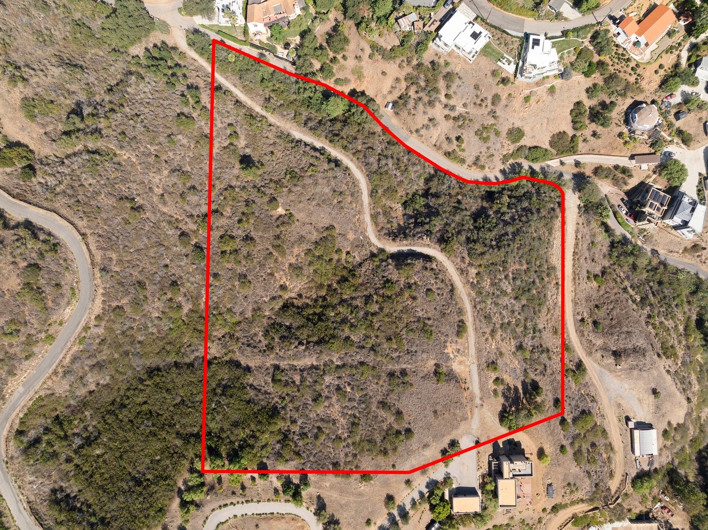
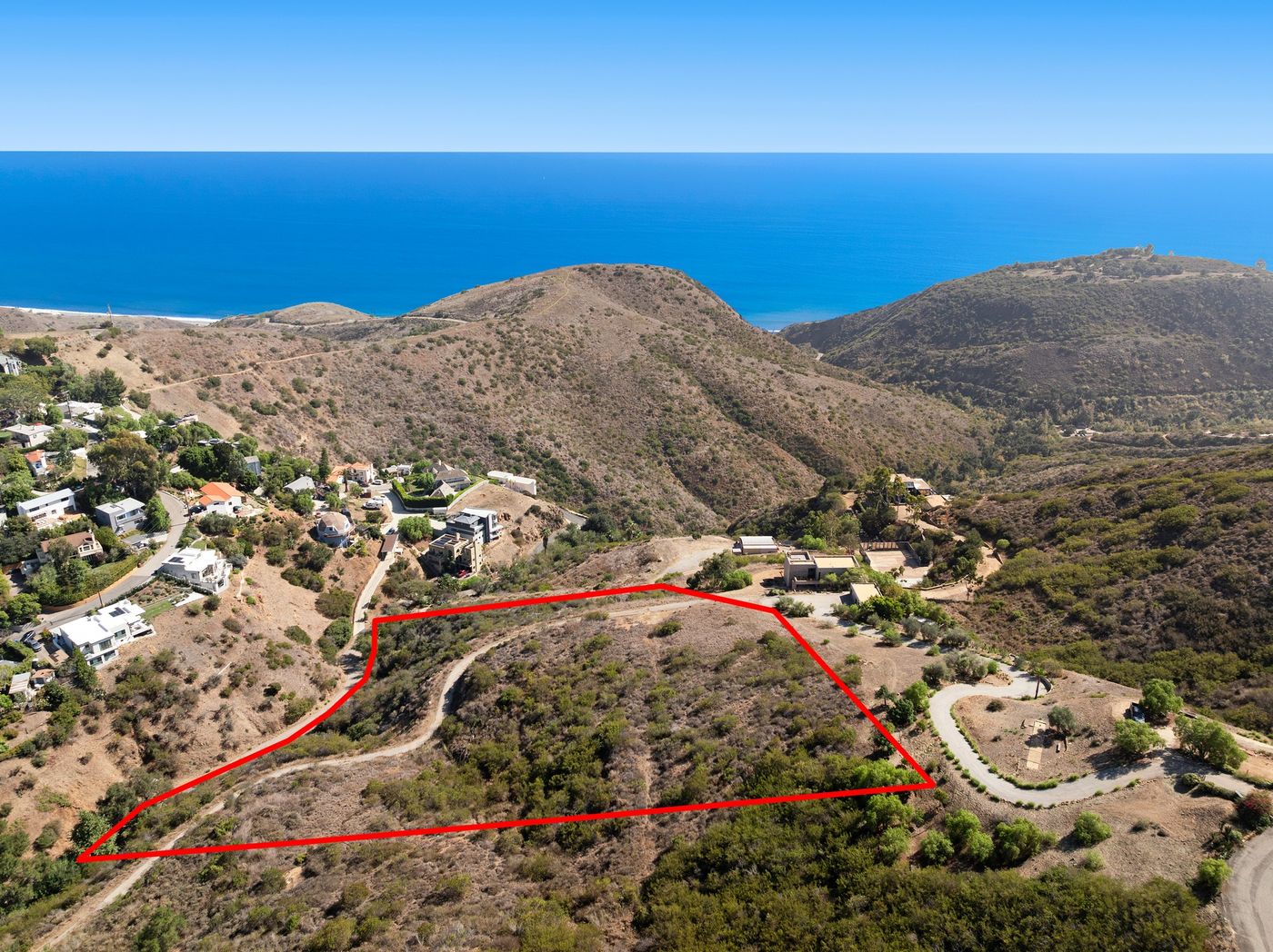
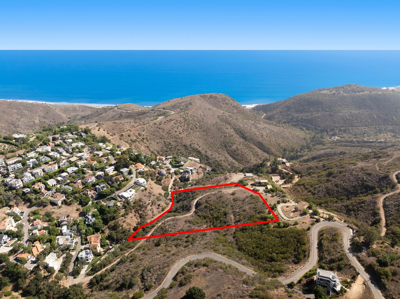
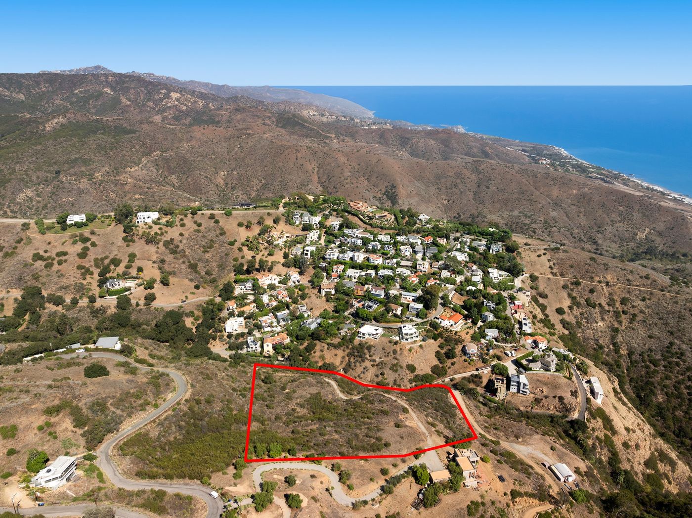
The outline is indicative only. It is not a survey, and the boundary is not established until one is done.
The land
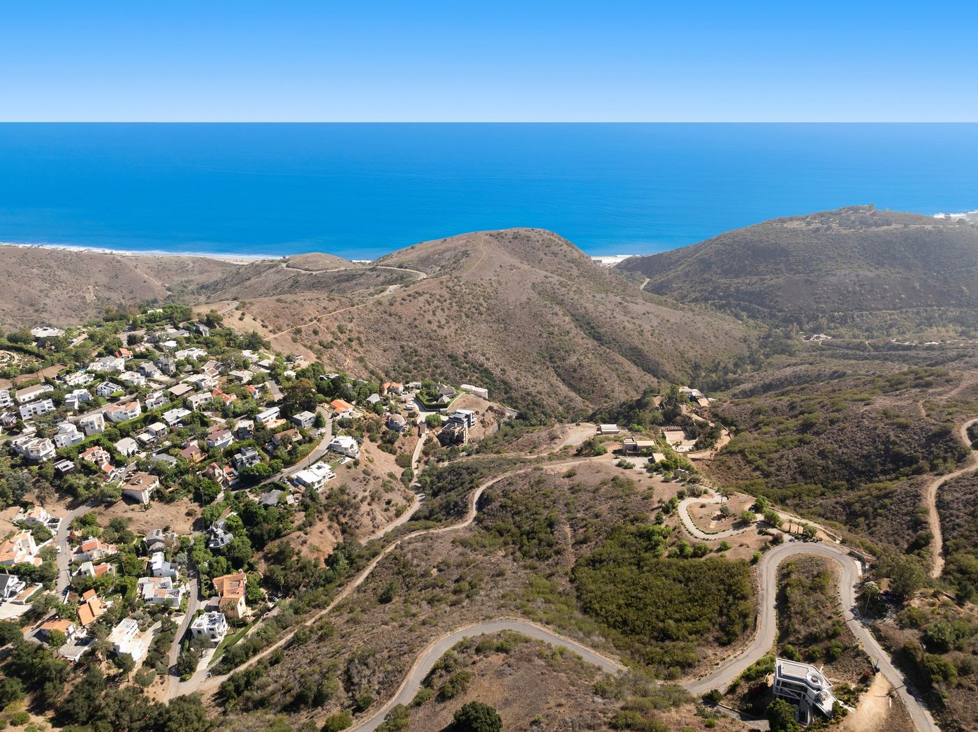
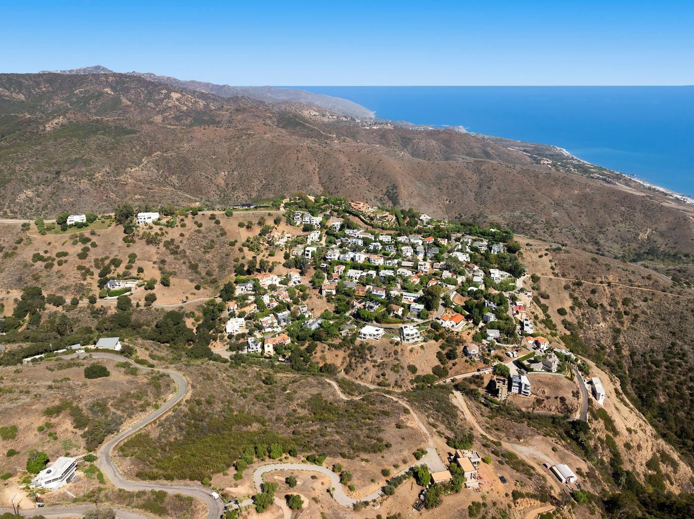
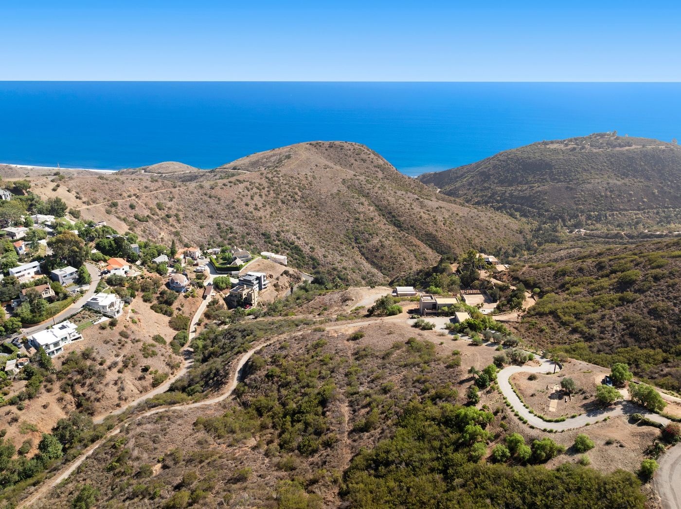
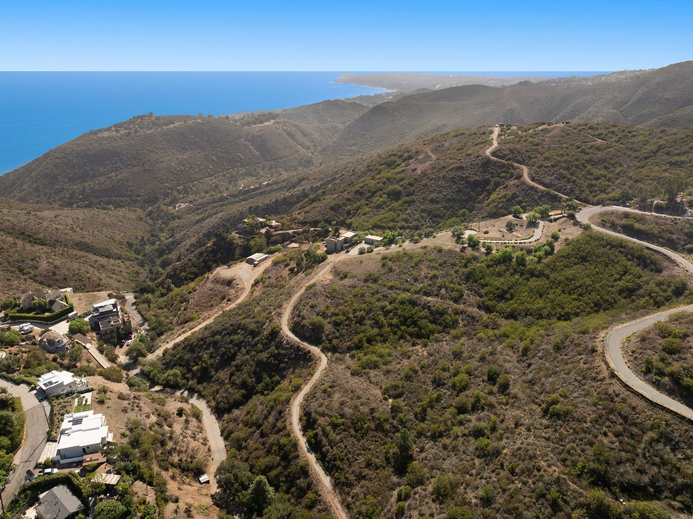
Five and a quarter acres, photographed from the air.
There is no house to show. What there is: the knoll, the canyon it sits above, and the water it looks at.